Around The Traps In Southeast Asia: Part 25
Megaworld Asia YouTube Link Megaworld Asia Facebook Link
The following trip report covers Phuket, Bali, and New Zealand, in January and February, 2023.

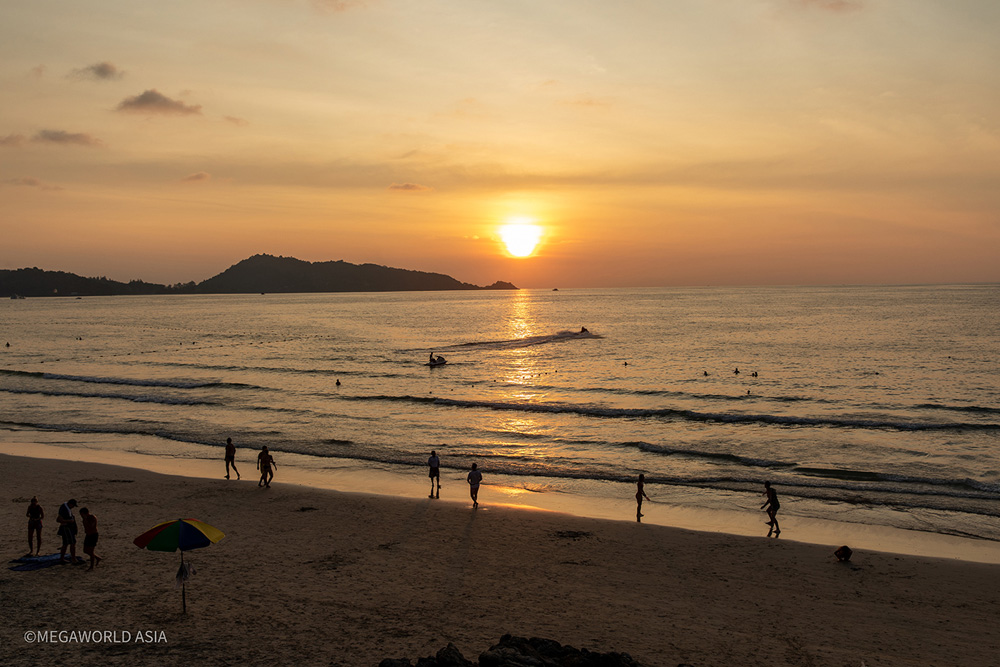
My last Phuket sunset for three months.
Phuket: After an enjoyable road trip through Phang- Nha, I was back on Phuket Island for a few days before setting off on a three-month sojourn to Bali, New Zealand, and Australia. I was a bit sad to be going, but I had some overdue catching up with friends, and family, which couldn’t be put off any longer. The unfortunate part about leaving Phuket towards the end of January was, after the unusually long monsoon, the high season had finally kicked in and the weather was superb. However, with the great weather came the hordes of tourists. Patong Beach was packed to the gunwales with Russians working on their tans, drinking, and stuffing themselves with seafood at the nighttime markets. Still, for all the negativity this might inspire from resident expats, even at the peak of the high season Phuket has plenty to offer.
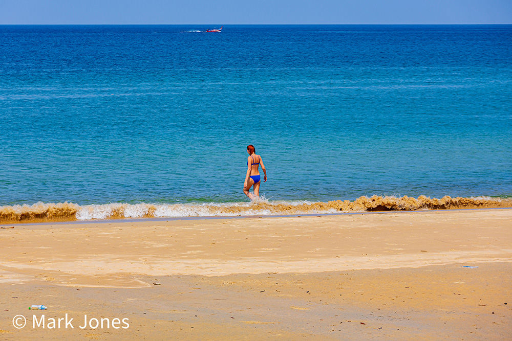
Karon Beach: To avoid the crowds on Patong Beach, I just head over the hill the northern end of Karon. The beach here is superb and, between the creek and the jungle covered hill at the northern end, often has few people on it. There’s a parking area with lots of tropical pine trees providing shade from the intense midday heat and nearby is the excellent LEK RESTAURANT, providing some of the best Thai and seafood dishes I’ve ever eaten. Lek’s is owned and operated by an affable local named Tony. For anyone going here, it’s the last restaurant on the right (beyond the cement road). It’s an open walled set up and a great spot to watch the sunset, while enjoying a Thai meal and a cold Singha.
The northern end of Karon Beach.
Patong dining: There are several good locations in Patong, away from the Bangla area, to get excellent western food. One of my favorites is ROSCO’S SPORTS BAR on Song Roi Pee Road. Rosco’s is advertised as an Australian sports bar and as such, shows most of the AFL and NRL games during the “footy” season. The owner, Dave, is a friendly type and is always happy to turn on whatever sport you want to watch, from the good selection of screens in the bar. They’ve got a great pub menu with the 300-gram pork chop, with mash and steamed vegetables being the top pick at just 300 THB. After you’ve finished eating, or watching your favored footy game, there’s a couple of happy ending massage shops, on either side of the restaurant, to check out if you’re so inclined.

Weekend buffet: The best value for money feed in Patong must be DONS BARBQ buffet, on the weekends – located on Nanai Road. When I’m in Phuket, this is the place I eat at every weekend. For just 350 THB you can fill yourself up on pork chops, ribs, sausages, chicken skewers, and the huge selection of salads on offer. For the Thai ladies, there’s also plenty of ahaan Thai available. The buffet starts at 5.00 pm every Saturday and Sunday. However, if you’re keen to check it out, get there early because the Russians have caught on to this place and pack it out by 6.00 pm. Note: There’s no happy ending massage shops next to Don’s.
Note: The following section of this report contains no commentary on bars, bargirls, whoremongering, or the adult night-life scene in Thailand.
BALI 2023
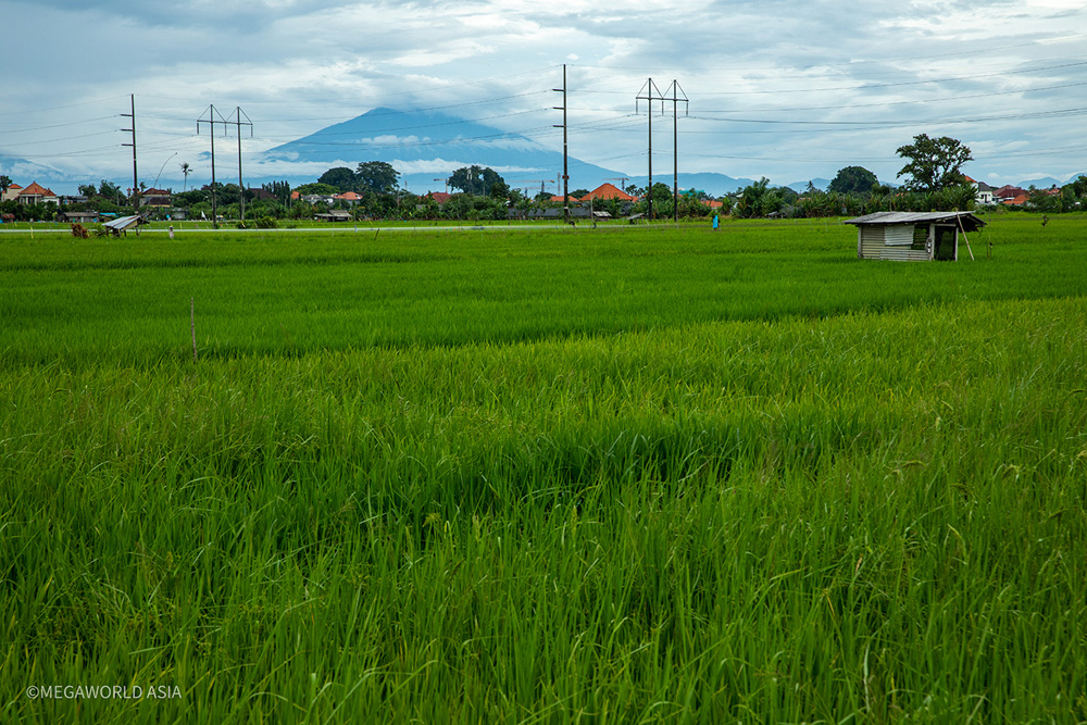
Green rice fields with a volcano in the distance.
The early days: Back in the mid-eighties an iconic Australian rock band, known as Red Gum, recorded a song called “I’ve been to Bali too.” It was satire, a bit of harmless fun, and a poke at little travelled Australians who thought they’d hit the big time, in terms of adventure, by going to Bali. More seasoned travelers would quietly snigger at the all too real lyrics which were directed at the boguns who’d hang around Kuta, getting drunk in the bars and clubs every night, without having the remotest interest in the culture of the people and the island.
Surfing: Bali first appeared on the tourist map, back in the early seventies. Initially as an off the beaten track surfing destination, for surfers looking for uncrowded waves in an exotic location. It was paradise back then. Incredibly good surf in an enchanting land of coconut palms and an ancient Hindu culture. By the mid-seventies the word was out, and the backpacker/hippie crowd began descending on the place. Generally motivated by the opportunity to score some inexpensive, easy to access drugs (pot, mushrooms, heroin) in a chilled-out location.

The 1970’s: My first trip to Bali was in 1976. I was a mad, keen surfer and arrived there having travelled through Sumatra and Java beforehand. There was still dirt roads running through kuta, and Legian was little more than cattle filled paddocks, with a few thatched roof bungalows near the beach. It really was paradise. As a surfer, it was quite possibly the world’s best surfing location at the time. Mainly because of the quality of the surf, the lack of crowds, and the lack of development. How things change.
Present day: After a 45-year hiatus, I returned to Bali in January 2023. Unfortunately, the uncrowded, undeveloped paradise of yesteryear is long gone. In its place is the inevitability of populism and mainstream, mass tourism. The idyllic days of the inexpensive thatched roof, beachside bungalows are a distant memory. Even though it was officially the low (rainy) season, the island was still packed with tourists looking for the “Bali experience.” I had a friend residing in Sanur, a location considered quieter than the more popular areas of the island; Semenyak, Cangu, and Ubud. Unfortunately, although considered a good location for the older tourist, Sanur is also a very crowded and busy place.
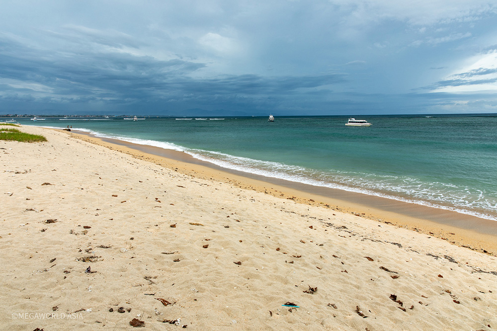
Sanur Beach, in the rainy season.
Getting around: The primary problem with Bali is the roads have not been upgraded to cope with tourist development. Although there’s a tollway linking the airport to both sides of the island, most of the roads (through the main tourist areas) are little more than single lane (each way) tracks from yesteryear. The roads are constantly choked with cars, trucks, motorbikes, and bicycles all dodging and weaving around traffic parked along one side of the road, and pedestrians with no footpaths to use. The businesses – restaurants, cafes, bars, massage shops and convenience stores – are built almost to the road edge. If you’re riding around on a bicycle, there’s a genuine risk of being knocked over at any given moment.
Dining: Balinese food is quite tasty, perhaps not as spicy as Thai, and if you eat at local warungs, it’s cheap. Warungs don’t attract the 17 % of additional tax and service charges that the tourist restaurants are required to tack on to the bill. Meal prices at tourist restaurants are comparable to Thailand.
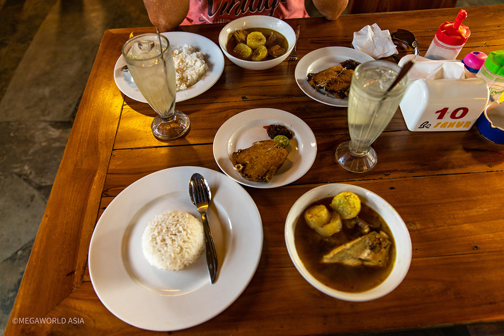
Local cuisine: fish head soup.
Religion: The predominant religion of Bali is Hinduism. Which is at odds with the rest of Indonesia, where Islam is the overwhelmingly preferred religion. As you travel around the island the influence of Hinduism can be seen everywhere in the architecture of the temples which dot the landscape. For the Balinese who have money, their homes are built to include this Hindu architecture. Many houses have Garuda, or Hanuman, styled statues flanking the entry gates. If you spend some time talking with a local, who speaks reasonable, it soon becomes apparent the Hinduism of Bali is infused with a local folk religion. The Balinese spend a lot of time trying to appease the perceived evil spirits. Incense is burned and small banana leaf baskets, with flowers, are placed at the gates of most houses to persuade the evil spirits to become good, before entering. Many of the footpaths around the villages have small flights of stairs to break the flow of the evil spirits along a pathway. To an outsider, this may all seem like superstitions mumbo, jumbo. However, to the Balinese, it’s a very serious part of life.
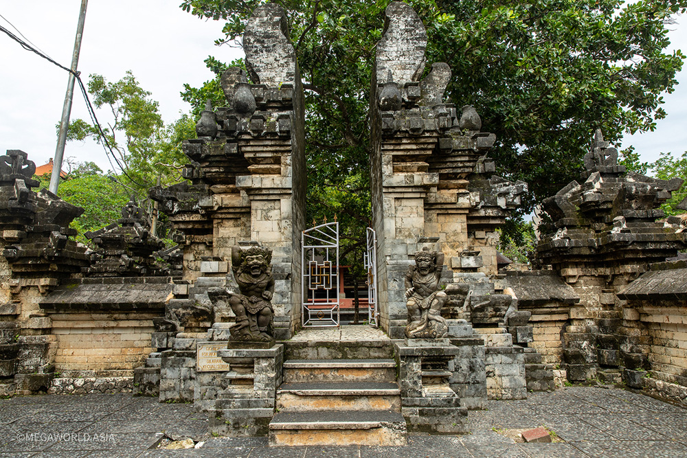
A typical Balinese entry gate.
Kintamani: The best time to visit Bali is probably May to October, the dry season. February is the peak of the rainy season and as such, there was often heavy downpours each day. This makes sightseeing a bit hit and miss, trying to time it between rain fronts. I was only there for ten days but fortunately had the guidance of a friend who’d been there, except for the covid era, for the past fifteen years. Noel proved to be an excellent guide and led me on some great bicycle rides around the back streets, and quieter areas off the beachfront. We did an excellent two-hour downhill ride from the rim of the Kintamani Volcano to Ubud Village. This was a guided tour which meandered along the small laneways, and through the rice paddies on the outer slopes of the volcano. Fortunately, the rain held off for the entirety of the ride and we were able to take in some interesting cultural stops on the way.
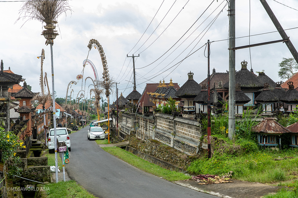
Typical village setting on the ride from Kintamani.
Ulawatu: Another excellent outing was a half day tour to Ulawatu Temple and lookout. This is an excellent sightseeing location at the southern tip of Bali and provides some great views along a cliff-line. There’s a temple there and as such, the locals consider this to be an important religious site. If you’re wearing shorts, you’ll be required to put on a sarong before stepping through the gates.
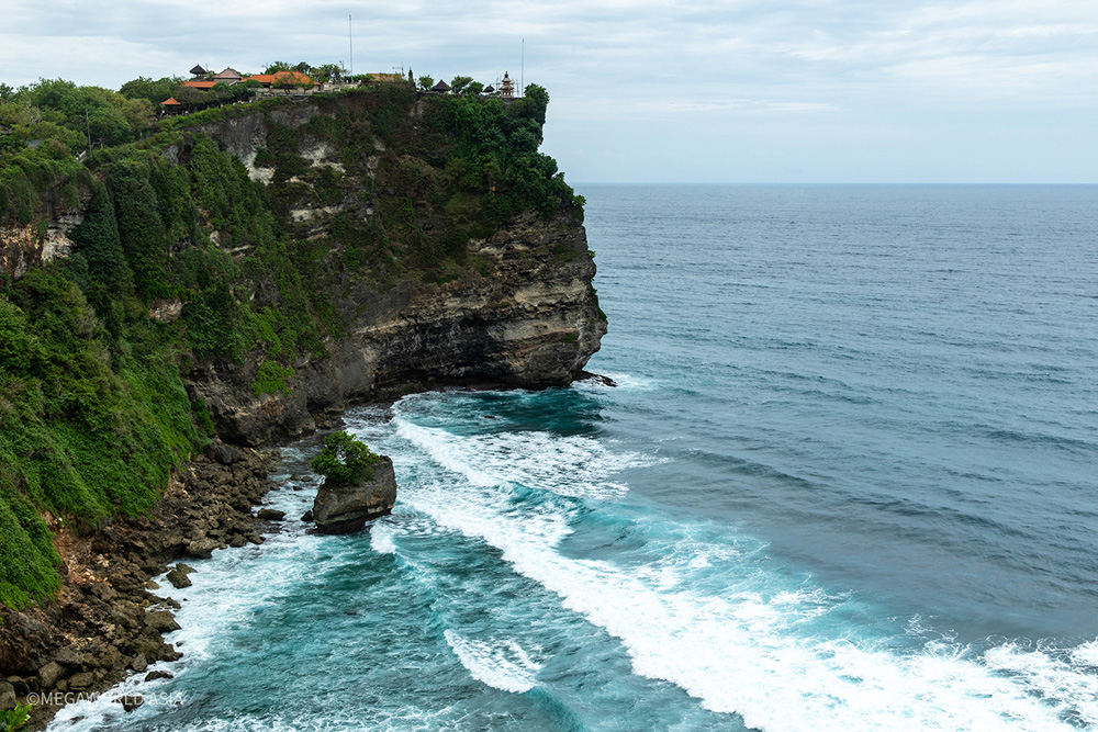
Cliff line view at Ulawatu.
Conclusion: All in all, I enjoyed my ten days in Bali. However, if you’re not into surfing, I still think Thailand is a better place to go, simply because it has a greater variation of sightseeing options.
NEW ZEALAND 2023
New Zealand; amazing scenery.
Weather: New Zealand (aka Aotearoa) is widely recognised as being one of the most picturesque places on the planet. It’s a photographers dream with its green landscapes, snowcapped mountains and turquoise, snow fed lakes. It’s a narrow land mass in the temperate zone of the southern hemisphere and as such, the climate can change rapidly. Visitors from warmer areas of the world are often surprised by how cold it can be, even in the summer months of the year. The sun can be shining brightly and creating the perception of a hot day. But if the wind is blowing from the south the temperature, when you step outside, can be quite brisk. During the summer, the average temperature is not much more than 23 degrees Celsius. Thirty degrees is considered a scorcher.
Preparedness: With this in mind, and memories of my early years in the Land of the Long White Cloud, I made sure I had a good supply of warm clothing when I boarded my flight from Denpasar to Auckland. It was early February 2023, and I was heading into what was generally considered the best weather month in New Zealand. When I arrived at my eventual destination, some fifteen hours later, I was hardly surprised to find overcast, rain-filled skies, and maximum of 19 Celsius.
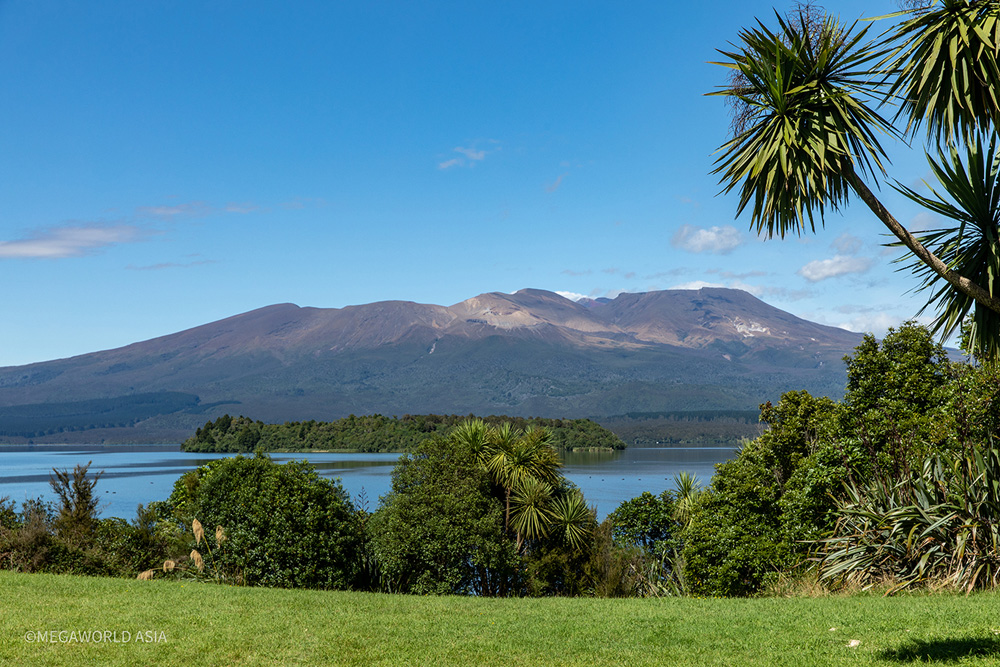
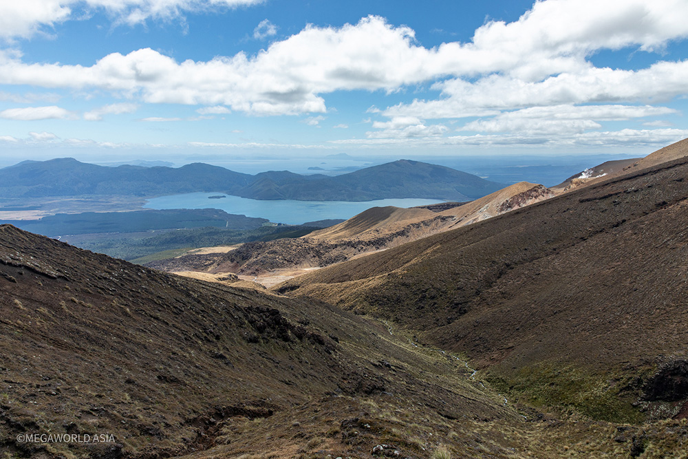
Geography: Taupo is a small city of 40,000, located around the northern shores of New Zealand’s largest body of fresh water. Lake Taupo has a surface area equivalent in size to Singapore Island. It is also the headwaters for New Zealand’s largest river, the Waikato. At its southern end is a range of rugged 2000-meter peaks which includes Mount Ruapehu, a popular skiing location, and Mount Ngauruhoe, an active volcano. At 2,291 meters in height, Ngauruhoe is the archetypal volcanic cone. From its rim, it slopes symmetrically to the surrounding landscape. It is possible to climb it but, when viewed from afar, the slope of its flanks look a challenge.
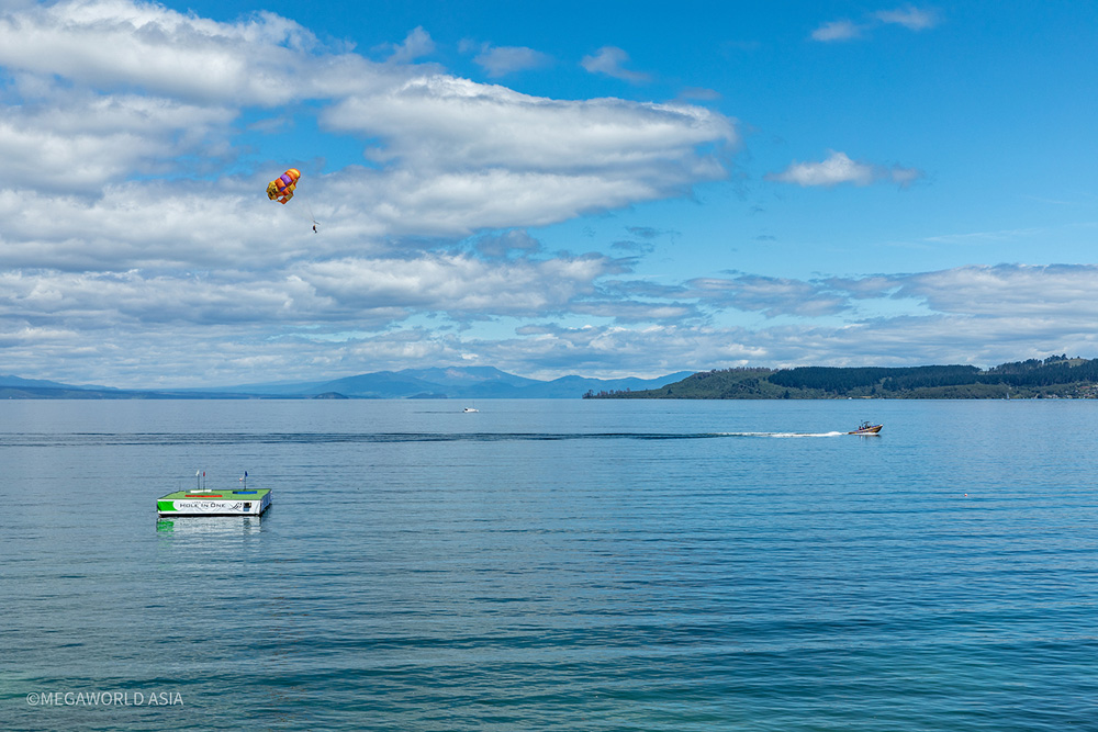
Lake Taupo; equivalent in size to Singapore.
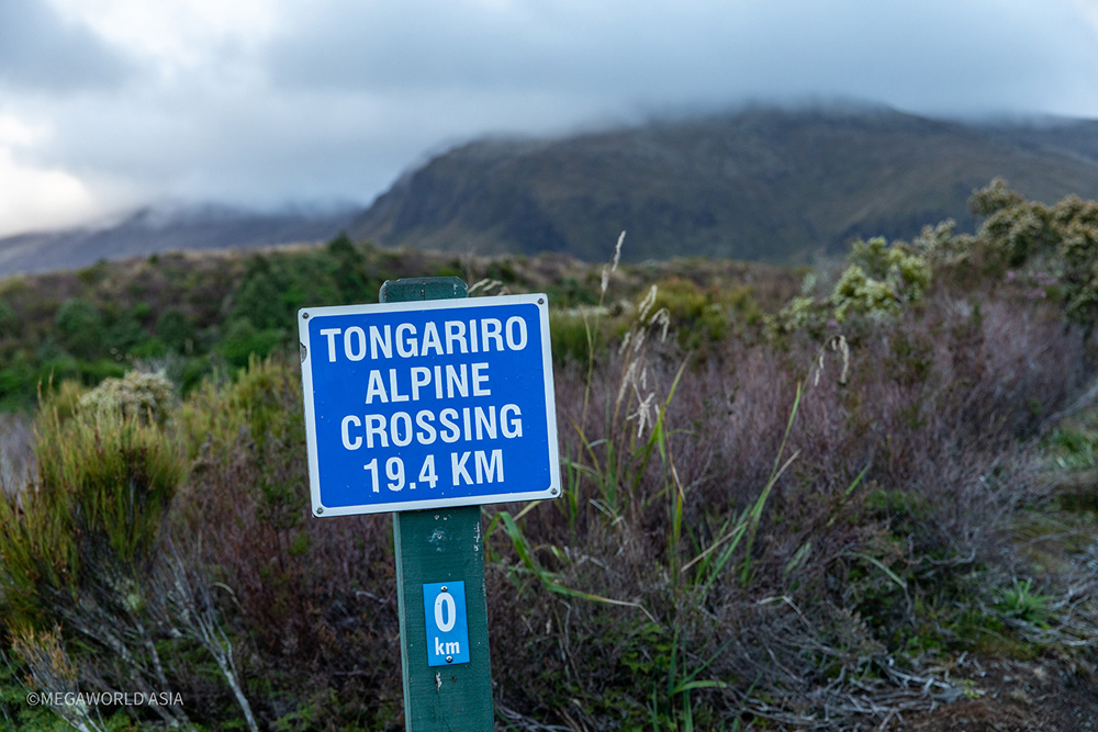
Adventure: I was planning to spend a few days in Taupo. Fortunately, I have a sister residing there, so forking out for expensive accommodation wasn’t an issue. During the summer months, Taupo is inundated with tourists, both local and international. Most of the international set tend to be the younger backpacker crowd, looking for a bit of adventure. The main drawcard of the area is the numerous hiking trails, through the mountains and peaks at the southern end of the lake. Of all the hikes available, the most popular is the challenging and spectacular, Tongariro Crossing. This hike, of 19.4 km, is classed as an Alpine half marathon.
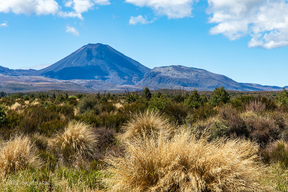
Ngauruhoe, as viewed from the surrounding plains.
Demanding: As mentioned, the Tongariro Crossing is classed (by the Taupo Tourism Info Centre) as an Alpine half marathon. The naïve may consider it a walk over a hill, but it certainly isn’t. The weather at the top of the trail, almost 2000 meters above sea level, can change dramatically in a short period of time. An initially clear day can deteriorate rapidly into a freezing white out of mist, or sleet, with strong winds. The advice given by the tour companies should be well heeded; take warm/waterproof layers of clothing, good hiking boots, waterproof gloves, food, and water. Additionally, hiking poles are a good option for the long trek down.
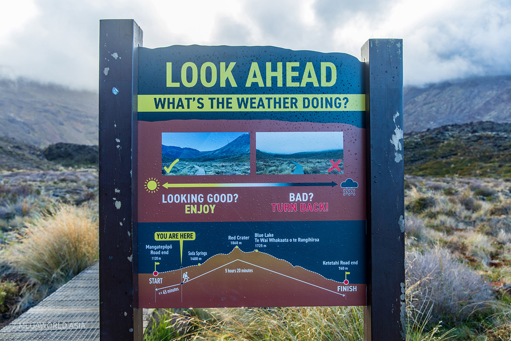
Tour: Prior to arriving in Taupo, I’d done some research on doing the Tongariro Crossing. Aside from being prepared in terms of clothing/equipment, and fitness, the main issue for me was transportation to, and from, the hike area. The start point is a location called Mangatepopo, approximately 100 kilometers south of Taupo. For anyone without their owns means of transportation, the best option is to use one of the local tour company bus services. In this regard TONGARIO EXPIDITIONS provided an excellent pick-up and return service, from Taupo. For 120 NZD they offer a shuttle service which picks you up in Taupo, transports you to the start point, picks you up at the finish point, and then returns you to Taupo. The pick-up time in Taupo is 5.15 am. Travel time to the Mangatepopo start point is approximately 1.5 hours. You then have approximately 8 hours to complete the 19.4 km hike and be at the finish point by 3 pm.
The start point.
Doing the crossing: A few minutes before 7 am, the Tongariro Expeditions bus arrived at Mangatepopo. There was a full complement of keen hikers onboard who’d been waiting for the overcast, rainy days to clear. With the arrival of clear weather there was a backlog of hikers (numbering in the hundreds) wanting to hit the trail. Before disembarking from the bus, the driver gave us a quick briefing about the expected conditions on the hike. He also handed out maps which showed key points and timings along the trail. On a final note, he reminded us the bus would depart from the finish point (Ketatahi Car Park) at 3 pm. Adding that, if anyone was late, the cost of a taxi ride back to Taupo was 500 NZD.
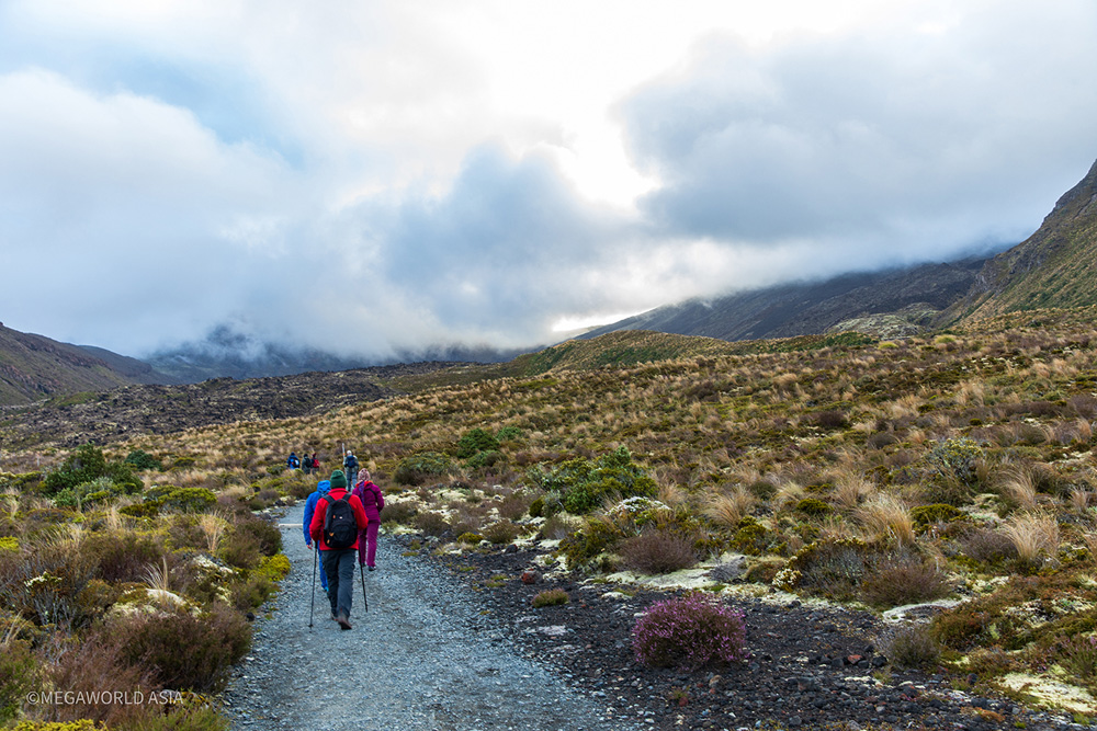
The first few km; the easy part.
Mangatepopo to the base of Red Crater Ridge: After a quick toilet visit, and a couple of minutes adjusting the contents of my backpack, I was off on the 19.4 km adventure. The initial section of the hike was relatively easy going, along a developed track, which gradually ascended through alpine/tundra like terrain. The timing to get to the base of Red Crater Ridge was 2 hrs, 15 minutes. As the trail rose into the peaks ahead, the terrain became a landscape of lava. There were quite a few hikers on the trail and as such, everyone had their phones and cameras out snapping off shots of the dramatic landscape. Up ahead I could see clouds beginning to form over the peaks, a forewarning of what everyone would encounter as we got higher.
Not looking too good up ahead.
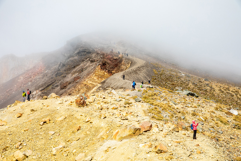
Red Crater Ridge: There’s a rest area at the base of Red Crater Ridge which includes portable toilets and some basic, wooden seating. Most hikers will take a break here, taking a few minutes to rest, have a snack, and drink some water before starting the difficult ascent to the summit. From the rest area the trail becomes significantly steeper. A few minutes after starting the ascent a heavy mist rolled in, reducing visibility, and creating a noticeable drop in temperature. As we got closer to the summit the wind speed increased to the point where the mist was being driven sideways. Hikers started dropping off the trail, looking for shelter behind large boulders.
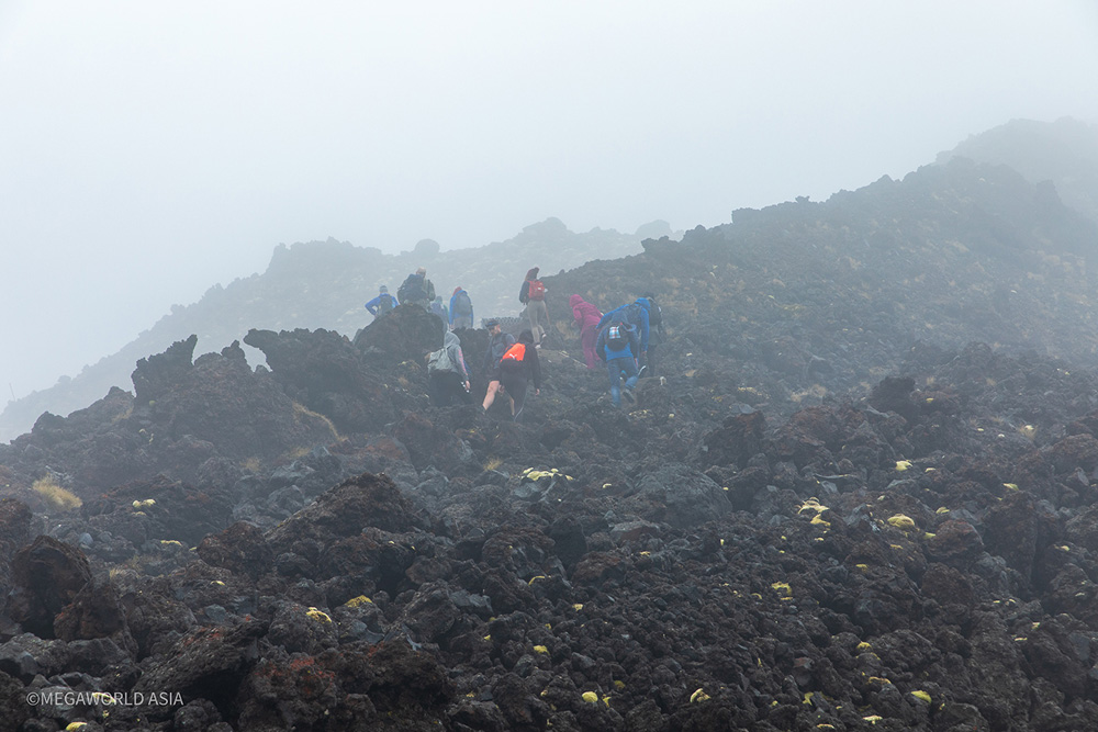
The weather turns nasty.
Red Crater Summit: Near the summit, the visibility was down to 10 meters. It was a white-out, being driven by a gale of at least 60 kmh. Quite a few hikers were turning back, saying “it’s very bad.” I decided to push on through the harsh conditions. Sheltering till the weather settled down would only create a delay, and I didn’t want to risk missing the 3 pm bus. As I neared the summit, the wind was howling. At the very top there’s a pinnacle rock. Others ahead of me, in the gloom, disappeared around the pinnacle. As I neared the pinnacle, I felt a sense of relief. I knew the downward side would offer shelter from the freezing gale. At the very top of the summit there’s a flat section of approximately 200 meters, before beginning the downward leg. Thankfully there’s marker poles in place, with reflective tape, every few meters to keep people on the trail. Going too far to the right, in such poor visibility, would spell disaster. It’s a sheer drop into the Red Crater.
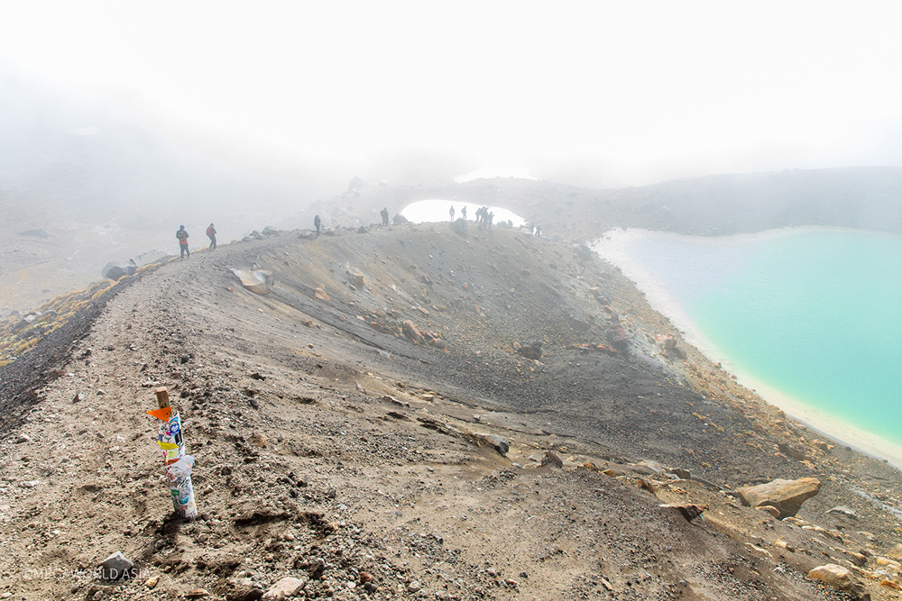
First view of the Emerald Lakes.
Red Crater summit to Emerald Lakes: From the flat section on the summit, there’s a steep drop down a ridge which skirts the red crater. As I began the descent, on the loose volcanic scree, the mist was still thick around me. I was in the lee of the wind but unfortunately, I couldn’t see the red crater. This was a bit of a bummer because the red crater was one of the highlight sightseeing attractions of the hike. In hindsight, if I had of sheltered for thirty minutes, I probably would’ve got to see the red crater. With my hands feeling frost bitten, I kept going down the scree slope. Up ahead were the Emerald Lakes. The scree slope leveled out as I got nearer to the lakes and on cue, the mist started clearing. There were quite a few hikers standing on a ridgeline between the two Emerald Lakes. No doubt appreciating the weak sunlight coming through the clearing mist. With the conditions clearing, I dropped my backpack and got the camera out to start shooting. After a few minutes spent shooting from various positions around the lakes, I decided to continue descending. There was still mist around the peak and I figured conditions wouldn’t get much better.
The mist begins to clear.
Go back up: The descent from the Emerald Lakes takes you out onto the flat expanse of a volcanic caldera. On the way there’s a nice view over another volcanic lake, of striking blue colouration. Approximately 300 meters beyond the Emerald Lakes there’s a directional signpost, telling hikers there’s another 10 km to the finish point. I stopped here for another photo and looking back towards the summit, noticed the mist had cleared completely. Noting I still had four hours of hiking time left, I decided to head back up to Emerald Lakes for some clearer shots.
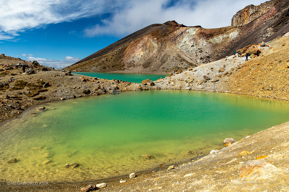
The Emerald Lakes
Crossing the caldera: I spent around 30 minutes getting some clearer shots around the Emerald Lakes and, with an eye on the time, headed back down to the caldera. The track across base of this large, ancient volcanic cone is flat and offers some fantastic distance views of the Red Crater, and Ngauruhoe behind. The ascent up the western edge of the caldera provided some exceptional elevated views of Ngauruhoe, and Mount Ruapehu as well. On the far side of the rim, a brilliant blue volcanic lake provided a great backdrop for a lunch break.
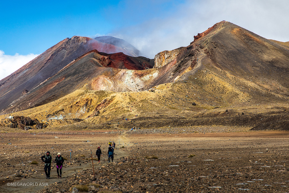
Looking back across the caldera; a fantastic view of Ngauruhoe and red crater
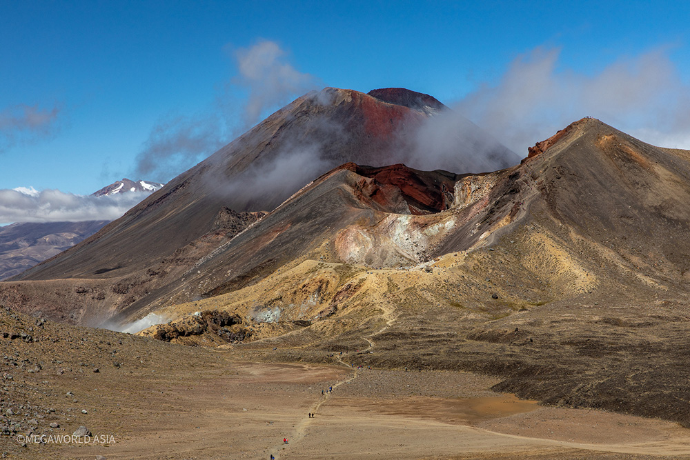
A wider view of Ruapehu, Ngauruhoe, and the Red Crater.
The downhill leg: The hike from the Blue Lake to the Ketatahi car park is approximately 9 km and will take a good three hours to complete. It’s downhill for most of the way. However, if you’re feeling a bit tired, this section is probably the most demanding as there’s constant stress on the knees from stepping down. If you’ve got existing issues with the knees, its highly recommended to use hiking poles to alleviate the repetitive impact. The landscape, for the most part, is a combination of smaller volcanic craters and sloping alpine terrain. The trail zig-zigs endlessly down the gradual slope but provides spectacular views out over Lake Rotoaira and Lake Taupo, beyond. The final three kilometers meanders through some picturesque native bushland, which provides welcome shade from the mid-afternoon sun. Note: While New Zealand may not be as hot as Australia or Asia, there’s something about the atmosphere which causes the sun to burn the skin even in lower temperatures. Apply plenty of sunblock for the descent to the Ketatahi Car Park.
The long descent to Ketatahi Carpark.
Conclusion: New Zealand has some breathtaking scenery, but it’s not a place to go if you’re keen for some nightlife action. It’s primarily an adventure destination with hiking (single and multi-day) through mountains and forests, being the most popular activity. During the winter months there’s plenty of skiing options available, on both islands.
Cyclone Gabrielle: One of my primary reasons for going to New Zealand was to have a catch up with Stickman. Unfortunately, one of the worst weather events to hit the North Island put a stop to this. The area he resides in (Napier/Hawkes Bay) copped the worst of it and the main highway, from Taupo to Napier, was impassable. Additionally, they were without power and cell phone coverage for several days after the cyclone hit. The place was a disaster area.
Until next time, safe travels.
Mega
Stick‘s thoughts:
Great report. Yes, it was a real shame that we never got to catch up with Cyclone Gabrielle putting paid to that. For readers, Mega and I had planned to do the Tongariro Alpine Crossing together but it didn’t work out and we ended up walking the track 3 days after he did. It’s funny looking at the photos I took which are very similar to yours. It’s a great walk, challenging and rewarding.
The author of this article can be contacted at : megaworldasia360@gmail.com